LandUse prediction
[1]:
from blocksnet import City, LandUsePrediction

city = City.from_pickle('../data/model.pickle')
[6]:
lup = LandUsePrediction(city_model=city)
Cosine similarity
[7]:
result = lup.calculate()
result.head()
100%|██████████| 16320/16320 [00:24<00:00, 663.45it/s]
[7]:
| geometry | land_use | |
|---|---|---|
| id | ||
| 0 | POLYGON ((354918.622 6625258.829, 354901.464 6... | None |
| 1 | POLYGON ((355412.142 6623378.149, 355411.700 6... | None |
| 2 | POLYGON ((353934.329 6625429.433, 353923.453 6... | AGRICULTURE |
| 3 | POLYGON ((355099.099 6623847.765, 355074.808 6... | AGRICULTURE |
| 4 | POLYGON ((352766.168 6621954.748, 352744.412 6... | RESIDENTIAL |
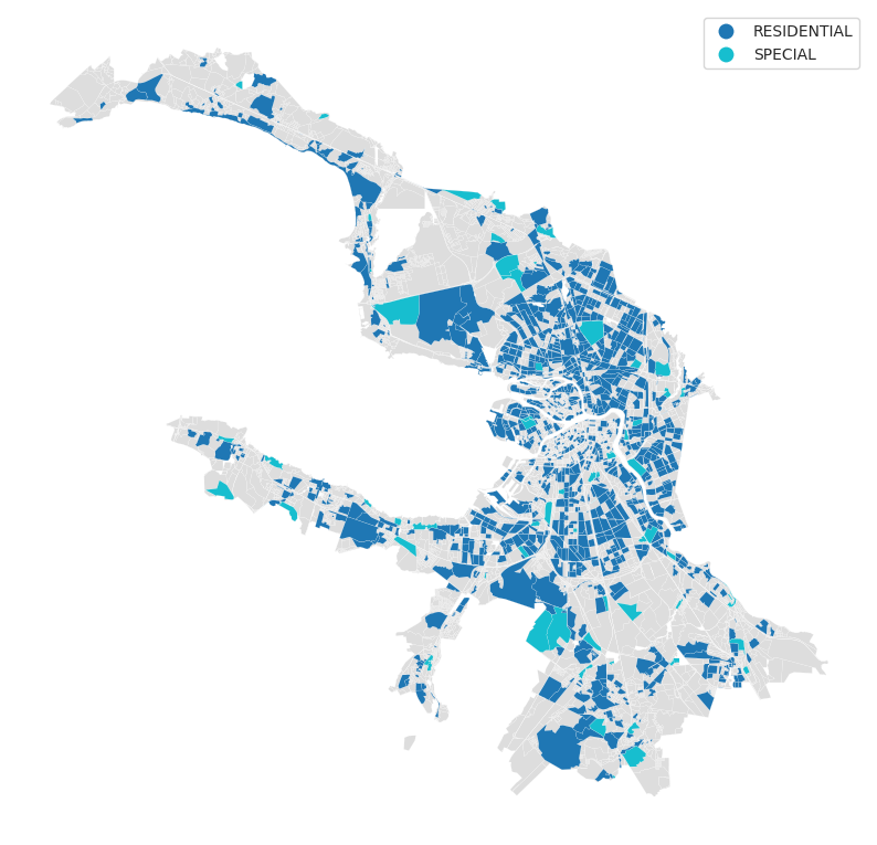
[8]:
LandUsePrediction.plot(result)
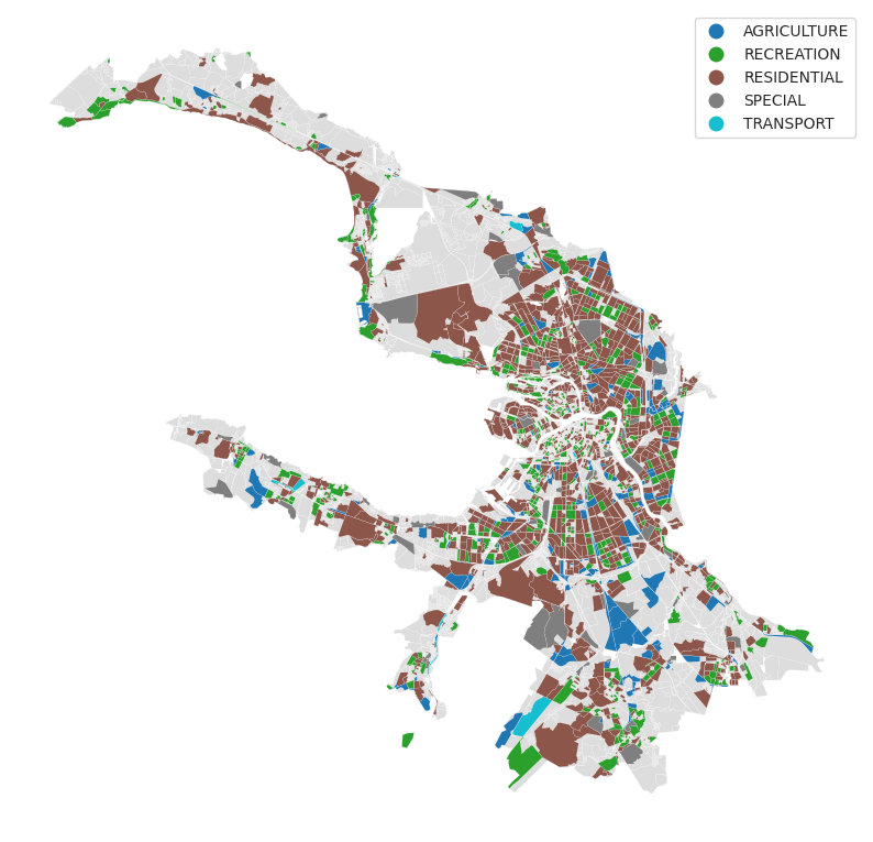
Other way around
[9]:
result = lup.calculate(False)
result.head()
100%|██████████| 16320/16320 [00:22<00:00, 725.87it/s]
[9]:
| geometry | land_use | |
|---|---|---|
| id | ||
| 0 | POLYGON ((354918.622 6625258.829, 354901.464 6... | None |
| 1 | POLYGON ((355412.142 6623378.149, 355411.700 6... | None |
| 2 | POLYGON ((353934.329 6625429.433, 353923.453 6... | None |
| 3 | POLYGON ((355099.099 6623847.765, 355074.808 6... | None |
| 4 | POLYGON ((352766.168 6621954.748, 352744.412 6... | RESIDENTIAL |
[10]:
LandUsePrediction.plot(result)